Padvi
I liked this app very much and I use this app from time to time for my needs.
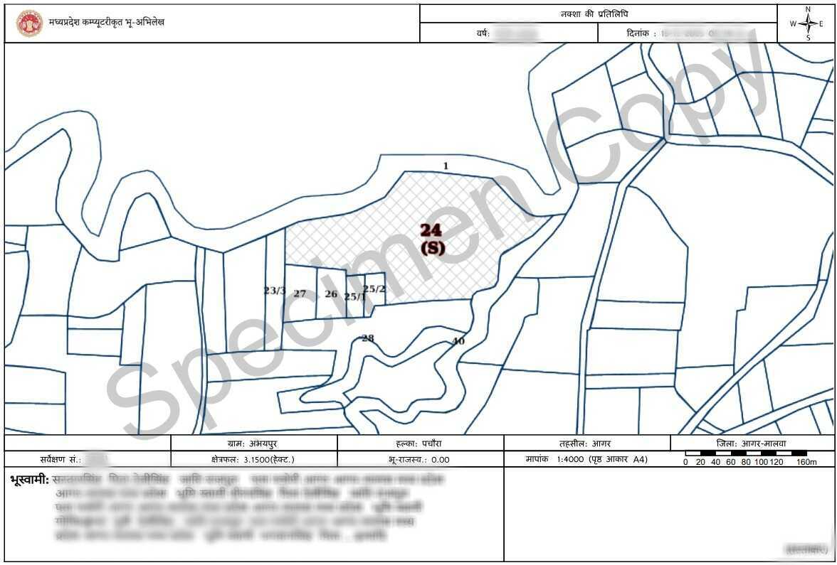
Bhunaksha is the official land map (cadastral map) issued by the Madhya Pradesh Land Records department. It visually represents land parcel boundaries, survey numbers and adjoining properties, helping users clearly understand the exact location and extent of a land parcel.
5 Lakh+
Happy customers
80 Lakh+
Docs downloaded
100%
Safe & secure
15000+
User Consultations
Is Bhunaksha a legally valid document?
Yes. Bhunaksha is an official land map issued by the Madhya Pradesh land records department and is commonly used for boundary verification and land-related processes.
Does Bhunaksha show exact land boundaries?
Yes. It clearly displays plot boundaries, survey numbers, and adjoining land parcels.
Can Bhunaksha be used for resolving boundary disputes?
Yes. It is frequently used to understand boundary alignment and identify encroachments or overlaps.
Is Bhunaksha available for all locations in Madhya Pradesh?
Yes. Bhunaksha maps are available for most villages and urban areas in Madhya Pradesh.
Can Bhunaksha help in land subdivision or plotting?
Yes. It helps identify existing plot divisions and is useful during subdivision or layout planning.
I liked this app very much and I use this app from time to time for my needs.
I had a good experience with this app and very supportive staff and delivering the documents within time.
Your service and responce are very fast and accurate. Your service is very good.
Very useful. This app and the team has helped me throughout my journey of claiming my land.